35+ YEARS OF CONSULTING AND PROJECT ASSISTANCE IN THE EARTH AND ENVIRONMENTAL SCIENCES
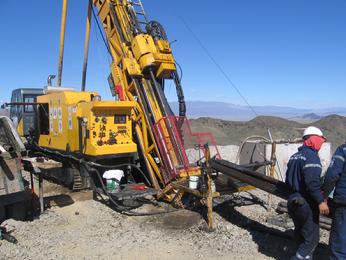
Au-Cu Exploration: 2 million acres in SW Mongolia. Summit Geology & Consulting Developed BMP's and Provided Technical Oversight
Summit Geology & Consulting, LLC has over 35 years of direct experience in the earth and environmental sciences. (303) 204-5394 randall@summitgeology.com
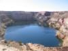
Open-Pit Gold-Archean Yilgarn Block: Western Australia
Mineral Lands/Resource Consulting and Research / Mineral Property Assessment-Evaluation / General Geology Studies-Geologic Mapping. Summit Geology is NI 43-101 and JORC Qualified
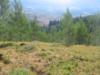
Mineral Remoteness Studies for Conservation Easements and Land Withdrawls/Transfers
Precious/Base Metals; Industrial Minerals; Strategic Mineral Resources